
From Delaware Floods to Perry Lake
Perry Reservoir Controversies
In early April 1951, precipitation in Kansas was slightly below normal. However, a prolonged period of above-normal rainfall began on April 20 and continued into July. Totals were about twice average levels. In May and June, the major streams rose, and high continuous runoff occurred from May through July.
An exceptionally severe storm began on July 9 and 10 and lasted through July 13. Flooding started on the Big Blue River above Manhattan. The waters swept through the basins of the Kansas, Marais des Cygnes, Verdigris and Neosho rivers in Kansas and the Missouri and Osage rivers in Missouri. Manhattan, Topeka, Lawrence and Kansas City all reported extensive flood damage.
An October 1951 U.S. Geological Survey report said, “For several days during the flood it was impossible to cross the Kansas River anywhere by train or automobile between Junction City and Kansas City, Kans. All roads and railroads running up the Kansas Valley were closed equally long or longer.”
The Kansas Historical Society’s Kansapedia website reported that the floods affected 116 cities and towns, damaging or demolishing 22,000 homes and destroying 336 businesses. About 10,000 farms also suffered damage. “The flood claimed 28 lives as more than 1 million acres were flooded. Total losses in the Kansas River Basin and in Kansas City, Missouri, and Kansas City, Kansas, exceeded $725,000,000.”
The U.S. Geological Survey reported damage to 17 major bridges, “some of them weighted with locomotives in an attempt to hold them.”

In Jefferson County on June 21-22, after a five- to six-inch rain upstream, the Delaware River overflowed its banks in Valley Falls, Ozawkie and Perry. Twelve or thirteen houses in Valley Falls were flooded to floor levels or above. The Ratz implement house and restaurant suffered water damage.
Losses in Ozawkie were primarily agricultural. The Oskaloosa Independent reported on June 28, “It was anticipated early this week that patches of wheat could be harvested, that some of the corn would survive. Some replanting of corn would be attempted provided the rainy season lets up promptly, (which it has no appearance of doing.)”
The Independent reported, “At Perry the flood came so rapidly and so much worse than the people could conceive might happen, that the town was totally unprepared for the event.”
A few dry days gave way to more rain, building up to 12 hours of downpours July 11-12. The Independent headlined a July 12 story, "Floods Grow Worse." The paper reported that Perry residents were abandoning their homes. Highway 24 was blocked west of Perry. North Topeka was evacuated. In Perry, the Kansas River crested at seven feet on July 13.
In the column beside the July 12 flood story, the Independent reported, "The Delaware River Basin Citizens Association has been working methodically on a conservation and anti-flood plan that will not only act as a deterrent on floods at Perry, at Lawrence and Cities below, but also provide for soil conservation, water detention and other benefits through out the area that lies within the watershed itself." Even before the floods, these plans had generated serious disagreement.

As the flood waters receded, the debate over flood prevention methods grew. Discussions, and sometimes quarrels, centered on the issues of federal funding versus local control. The U.S. Corps of Engineers promoted building large dams on major waterways. The Soil Conservation Service of the U.S. Department of Agriculture favored smaller, upstream dams. Urban areas that desired water for industrial purposes supported large dams. Rural residents preferred to see the land enriched rather than inundated.
River basins in the Great Plains have a history of flooding. Some of the earliest recorded flooding was in 1826, when floods struck the area in both spring and fall. On the Neosho River, log buildings, fields and fences were swept away in one night. Severe flooding occurred again in 1844, ten years before Kansas was opened for general settlement. Historian David Dary reported that the water where North Topeka now stands was twenty feet deep, and the Papan brothers’ ferry was demolished.
In More True Tales of Old Time Kansas, Dary wrote, “Sarcoxie, an old Delaware Indian chief, recalled many years later how the valley of the Kansas River flooded from west of modern Manhattan, Kansas, east to where the river flows into the Missouri at present-day Kansas City. Near what is now Lawrence, Sarcoxie told how the river had stretched from the bluffs in Jefferson County south to what is called Blue Mound, which is southeast of modern Lawrence in Douglas County. At that point the Kansas River was nearly ten miles wide until the flood waters receded.”

The Delaware River flooded in Osawkee in 1872. In 1897 and again in 1903, the mill at Thompsonville was inundated. Heavy flooding in 1903 collapsed a portion of the Kansas River bridge at Lawrence. In 1908, the Kaw overflowed its banks for a month. Ozawkie organized a Delaware drainage district in 1908. In 1914, a drainage ditch was dug to divert the Delaware from Ozawkie, but the river flooded again the next year, and once more in 1925. By the late 1930s, the federal government had begun to consider building a major dam on the Delaware River.

With the 1944 Pick-Sloan Flood Control Act, construction of large reservoirs began, starting with the Kanopolis Dam on the Smoky Hill River. The proposed Perry Reservoir would dam the Delaware River and inundate more than 11,000 acres of farmland and timber as well as drowning the town of Ozawkie.
On July 5, 1951, after the first flood at Perry, Henry Weltmer, publisher of the Perry Mirror, strongly advocated rapid construction of the proposed dam: “As I, and many others see it, there is only one way to stop the flood danger that has existed in this area for years. That method is by building the reservoir suggested and proposed by the U.S. Army Engineers Corps . . . It is a certainty now that small dams, conservation practices and the like will never do the job.”
Those who lived and farmed in the Delaware valley saw it differently. In February 1948, Ozawkie citizens met to organize opposition to the proposed dam. They selected Claude Brey, a local farmer and Grange leader, to represent them at a hearing in Washington, D.C. Brey, Glen Lehman, Casey Dick and Paul Cawley appeared before a committee of the War Department’s Engineering Division of Rivers and Harbors to present their objections and alternatives to the dam. Responses were not encouraging. Brey later reported, “I felt like a little bitty fish in a bowl of big fishes.”
Claude Brey, Raymond Wegner and Glen Lehman toured Washita conservation projects in Oklahoma in 1950. Elmer T. Peterson, editor of the Daily Oklahoman, opposed the large dams in his state, pointing out that the advantages fell to downstream residents. He favored the approach of the Delaware River Watershed Association: “This flood control takes each little watershed and treats it by soil conservation practices so the water is held at or near where it falls. The real job . . . is done by terracing, regressing, contouring and other practices. The relatively small detention dams are the extra precaution – the safety margin.”
About a month before the 1951 flooding began, the Delaware River Basin Citizens Association expanded into all the counties of the Delaware and its tributaries: Jefferson, Jackson, Atchison, Brown and Nemaha. Renamed the Delaware River Watershed Association, the organization included residents of the entire watershed and others with personal and business interests in the area.


The organization divided the area into watershed districts:
1. Wild Horse Creek
2. Rock Creek
3. Big Slough Creek
4. Little Slough and Brush Creeks
5. Coal and Walnut Creeks
6. Cedar Creek
7. Elk Creek
8. Straight Creek
9. Grasshopper Creek
10. Little Delaware
11. Muddy Creek
12. Craig, Plum and Delaware Creeks
The association’s plan called for individual farmers and landowners to adopt its program voluntarily. All land was to be used for the purposes for which it was best suited. Certain areas were to be reseeded to grass. Contour or strip farming, terracing and seeded waterways, and gully control were encouraged. The goal was to retard water runoff, replenish groundwater and reactivate springs. This would provide increased moisture for crop production, particularly during dry seasons. Farmers were also encouraged to build detention reservoirs to hold flood water temporarily, releasing it gradually without damage to pasture grasses.
These measures were intended to avoid the wholesale inundation of agricultural land that would result from constructing a large dam and lake.
The Kansas Power and Light Company and the Kansas State College Extension Service prepared an exhibit of miniature farms, comparing various types of land uses and farm management practices. Housed in a truck, the exhibit toured the watershed area for a series of meetings in support of the Delaware River Watershed Association’s plan.
Delaware valley citizens had support and encouragement from other areas facing permanent flooding. The Blue River Watershed Association urged smaller dams upstream instead of the large Tuttle Creek Dam. In 1957, the Missouri Basin Survey Commission, established in 1952 by President Truman, delivered a negative report on plans for several large dams, including Perry.
On July 13, 1951, Perry Mayor Norman Hamm appeared before a Senate appropriations committee in Washington, D.C. While a second flood swirled through his town, Hamm promoted the Perry dam. Raymond Wegner of Ozawkie argued the opposite position, with skeptical responses from the committee. Hamm came away with promises of federal aid for Perry and plans to organize a new Perry Flood Control Committee.
In an editorial in the Oskaloosa Independent, July 26, 1951, Senator Frank Carlson advocated for the big dams: “Fifteen years ago the Federal Government accepted as a national duty the protection of its citizens from floods. It embarked on a program of construction which has caused many structures, dams and walls to be built across the country.
“The best engineering talent of the world was consulted and used to put in concrete form a proposal which would put in operation structures that would forever remove the fear of flood. The Kaw will be made tame by means of three dams and ten local protection projects to be built by the Corps of Engineers.
“It is imperative that we have action and have it now. The floods have not neglected their opportunity and today Kansas is the recipient of sympathy from across the Nation. Congress has passed emergency legislation. Foreign governments have expressed their sorrow to our President. These well-meaning gestures will never bring back the lost lives nor the soil nor the homes or factories. Nor will they prevent the same thing happening again.”
Congress authorized construction of Perry Dam in 1954. Ozawkie citizens launched a 10-year campaign to change the name to Ozawkie Dam and Reservoir. The March 20, 1958, Oskaloosa Independent asked, “Why Not Ozawkie Lake and Dam? It is the people of Ozawkie who will pay the greatest price in loss of homes and farmland and their businesses.”
In 1964, the Jefferson County Pomona Grange petitioned Representatives Ellsworth and Avery and Senator Pearson for the name change, but their proposal was tabled and never brought to a vote.
Failing to prevent inundation, the people of Ozawkie turned to relocation. In Ozawkie on the Delaware, local historian Erma Steffey wrote, “Since Ozawkie was an unincorporated village the Government would not relocate the town. If it was relocated it would have to be done by the people.” The people chose a new site for Ozawkie, northwest of the old town, and hired attorney William C. Leech to help them incorporate. Leech and Ozawkie Board of Directors President W.A. Kramer negotiated with the Corps of Engineers, which had set the property aside for recreation. The townspeople formed a corporation and bought the land, near the site of an early rival town, Pleasant Hill.

Erma Steffey described complaints by landowners in the future reservoir area: “The Corps was marching up the valley from the dam site . . . taking property and homes far below the replacement cost of comparable property in other locations.” Court cases were filed, and Ozawkie farmer Gary Parker took the complaints to Washington, D.C., “stating that everyone was not being treated equally as this is a forced sale.”
Judith Taggart quoted Delaware valley cattle rancher Mrs. Tom Noll in the Kansas City Star, June 30, 1963: “Even when we do buy a new place, we’ll lose three years in moving – the silos won’t be full, we won’t be able to plant wheat this fall, and we’ll need one dry and one wet season to get to know the ground.”
Construction of the rolled earth fill dam began in August 1964. The complex undertaking encompassed clearing trees and grubbing stumps, excavating for the embankment, constructing the outlet works and control gates, plus building roads and bridges to service the area.
A 1965 Corps of Engineers pamphlet described the process: “To build earth dams the engineer uses materials that Mother Nature has left close at hand. The core is made from clay, which when compacted with heavy rollers becomes practically water tight. On the downstream side of the water-tight core, the engineer adds a drain, made of sands that will readily pass water. Through this drain flows the small quantity of water that may pass through the core. Riprap, which consists of medium to large pieces of rock, is placed on the upstream slope of the dam to prevent erosion resulting from wave action.”
In June 1964, the Oskaloosa Independent reported that Robert Hudson, a Spring Hill construction worker, was killed at the Perry Dam project when a 2,000-3,000-pound piece of corrugated steel culvert fell on him.
In July 1965, digging crews from the Kansas Historical Society found an early Native earth lodge 700 to 800 years old south of Ozawkie. When the graves of five white settlers were also found, digging stopped. These graves had been dug through the earth lodge site. Anthropologists from the University of Kansas later excavated the site along Big Slough and Evans creeks. According to local memory, one of the burials was that of two-and-a-half-year-old Nettye Busbee, who was burned to death in a grass fire. Mabel Mills Shereman, Nettye’s niece, told Nettye’s story to Fern Vanderpool in 1983. Vanderpool contributed it to "Yesteryears" in April 1989.
[Nettye's story was reprinted in "Yesteryears" in October 2021. Visit https://www.jchsks.com/publications Fall 2021.]
Two cemeteries were relocated because of the reservoir. Fairview Cemetery, 10 miles northwest of Perry (not to be confused with the current Fairview Cemetery, near the old site of Dunavant north of Oskaloosa), held about 160 graves, dating from 1868 to 1954. Most Fairview burials were moved to Rose Hill Cemetery near Perry. Five Limeburner family burials (circa 1873) and three Crone family burials were also moved to Rose Hill.
In June 1967, the Delaware flooded again, giving residents of the new Ozawkie a preview of the lake. Ozawkie was incorporated in its renewed form September 15, 1967. W.A. Kramer was elected its first mayor.
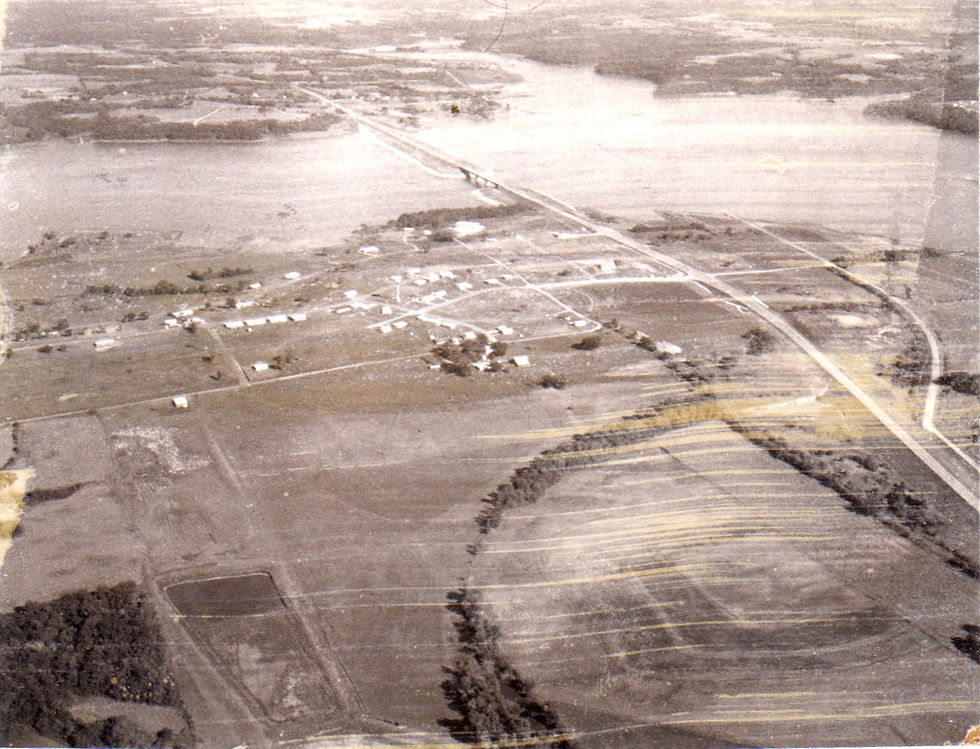
Dam construction finished at the end of 1968, and the two 32-ton control gates were closed in 1969. Perry Reservoir officially opened in August 1970. The dedication featured a sailboat regatta and a U.S. Army Golden Knights parachute show. In its first year, the area attracted some 1.6 million visitors. Vehicle traffic was so heavy that the Jefferson County Commission asked U.S. Senators James Pearson and Bob Dole to introduce legislation authorizing the Corps of Engineers to pave the most traveled access roads.
Opposition to the reservoir did not vanish overnight. Martin Vanderpool of the Ozawkie board of directors told skeptics, “Some of us fought the reservoir for 20 years. We decided to stop fighting and start working. I have confidence that the development around the lake is going to be tremendous.”

By Jane Hoskinson, with thanks to Ardie Grimes and Deb Case for research and technical support.
This article appeared in “Yesteryears” in October 2021. https://www.jchsks.com/publications
US Army Corps of Engineers: Perry Lake
The US Army Corps of Engineers constructed and operates Perry Dam. Located on the Delaware River in Jefferson County, Perry Lake is the fourth largest lake in the state of Kansas. The Delaware River and its tributaries Slough Creek, Rock Creek, and Evans Creek provide the inflow and valleys that form the lake area. The lake possesses over 160 miles of shoreline, 25,389 acres of flood control pool, 11,150 surface acres of multipurpose pool, and controls a drainage area of about 1,117 square miles in the comparatively humid region of northeast Kansas. Flood protection includes over three thousand acres downstream of the dam along the Delaware River and contributes to the protection of the Kansas River, Missouri River, and the Mississippi River. The communities of Perry, Lawrence, Bonner Springs, and Kansas City benefit from the flood control protection. https://www.nwk.usace.army.mil/Locations/District-Lakes/Perry-Lake/


